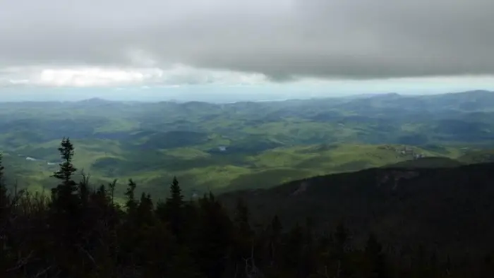
The views from the Dix Range are some of the best in the Northeast! With five different mountains, this traverse offers something rugged and adventurous for hikers. This range includes five of the 46 High Peaks: Macomb, Grace Peak, Carson Peak, Hough, and Dix Mountain.
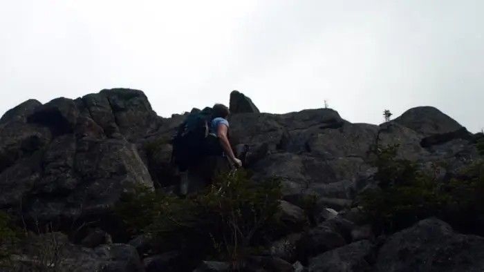
This is a rugged hike and we highly recommended hikers use a map and compass (and guide book) or hire a local guide. The terrain is steep and there are exposed sections. And at over 15-miles, this loop covers a great distance with lots of elevation gains and descents. Hiking these mountains all together in a loop is the preferred option. One important thing to note: expect for the trails leading up to Dix Mountain, there are no official trails in this Range. Most of it is traversed via herd paths. Hikers should be prepared to navigate the backcountry with use of map and compass.
The Dix Range by the numbers
Dix is the 6th High Peak, at 4857 ft.
Macomb is the 21st High Peak, at 4405 ft.
Hough is the 23rd High Peak, at 4400 ft.
Carson Peak (formally South Dix) is the 37th High Peak, at 4060 ft.
Grace Peak (formerly East Dix) is the 42nd High Peak, at 4012 ft.
How to get there
The following descriptions describe hiking the Dix Range from the Elk Lake trailhead. To get there, take Exit 29 on I-87 and follow Blue Ridge Road to the west, toward Newcomb. Continue for 4-miles to Elk Lake Road on the right. (There is a sign for the Elk Lake Lodge.) Follow this road to the hiker parking, near the end.
Hiking
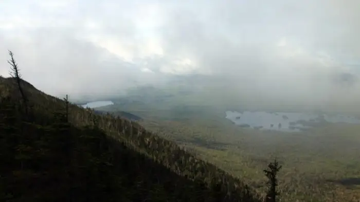
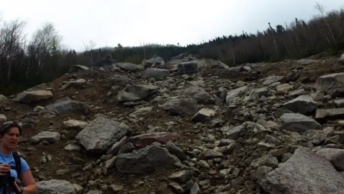
From the parking lot at Elk Lake Lodge, follow a very well used marked trail to the Slide Brook campsites and lean-to. After crossing Slide Brook, go right and up through a campsite to access the very plain (in most conditions) herd-path that proceeds high above the brook through a peaceful forest before descending slightly to the base of the slide. The slide is mostly rubble, scree, and loose sand. It's very steep making for even harder footing, especially if descending. The upper portion of the slide is a bit tough to exit but once you do, you will be back in the trees for a bit further to the summit. Once above the slide, the summit is still a steep climb through the forest, but not all that far away. The views from Macomb are quite nice, but only in one direction back toward and over Elk Lake. The herd path to South Dix heads over the summit area and down the ridge.
South Dix is the next mountain in the Dix Range loop. Keep in mind, this can only be climbed in combination with other mountains in the range; there is no direct trail or herd path. South Dix has a wooded summit with limited views, but excellent views can be had from the south shoulder, which is on the route from Macomb.
Next up is Grace Peak (formally East Dix). Grace Peak is not directly on herd path loop for the Dix Range; it's a bid of an outlier. That said, it's only a short jaunt over to it's summit. Remember still, while the paths are relatively plain, there are no markers on this route. The summit is a mix of open rock and trees. A large boulder marks the true summit.
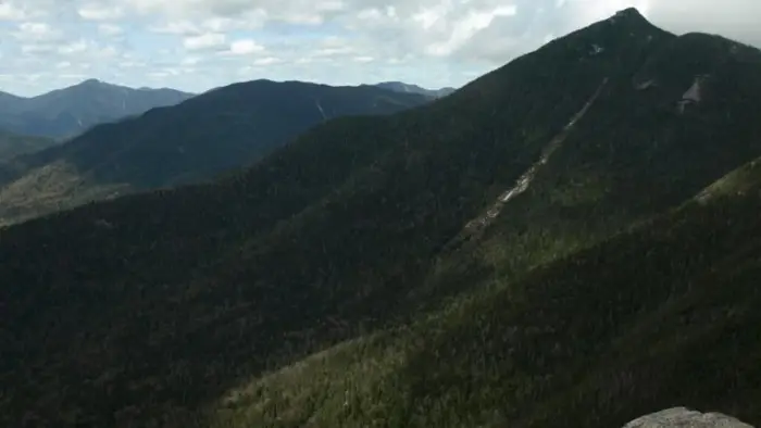
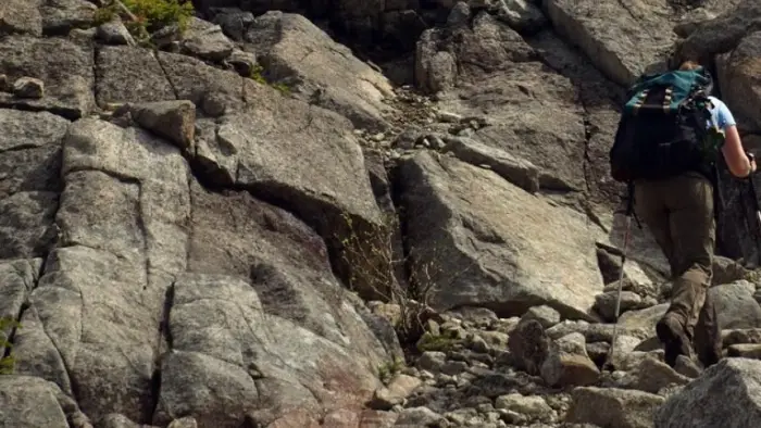
Following a visit to Grace Peak, hikers continue on the loop to Hough (pronounced "huff"). Hough isn't the biggest mountain in the range, but it does offer some unique and mind blowing views of the area. Hough is possibly the most memorable of the five peaks in the Dix Range. Hough is one of the tougher sections in the range with tight herd-path conditions and rock scrambling to boot.
From Hough, descend steeply into a col between a sub-summit called "Pough" and Dix Mountain. It's another steep climb to the summit of Dix, where hikers are greeted with open views of the surrounding area. From Dix, hikers can descent back to the Elk Lake parking lot via the Beckhorn Trail or Hunter's Pass. Hunter's Pass is a longer trail but slightly less steep than the Beckhorn. After a long day on the trail, most hikers prefer to take the Beckhorn Trail, which is marked, along with Hunter's Pass. Eventually the trail levels out, and hiking along a flatter section will be a welcomed break for your knees. Keep in mind, though, this section may be muddy.
Read more on our blog here: The Dix Range Traverse.
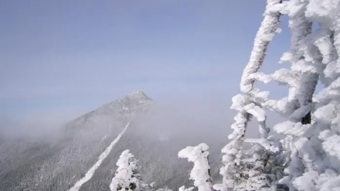
Dix Range in winter
This route in the winter can be very challenging. There is a good chance it will not be broken out and hikers should be prepared to expend extra energy hiking through deep powder. In addition to winter conditions, parking is also a difference for hiking in this season. The lot at the end of Elk Lake Road is closed and hikers will need to park at Clear Pond, which is located 2-miles from the the trailhead, adding 4-miles to the trip RT.
Camping
Along the trail from the Elk Lake parking area to Dix Pond, look for eight primitive campsites and the Slide Brook and Lillian Brook lean-tos.
Camping between 3,500 feet and 4,000 feet is limited to designated campsites. Camping above 4,000 feet is prohibited.
History
Two mountains in this range have a very interesting history, and names to boot! East Dix was renamed to Grace Peak recently in commemoration of Grace Hudowalski, who was the first woman to climb the 46 High Peaks. Grace became Forty-Sixer #9 August 22, 1937 on Esther. She worked for New York State to promote tourism and devoted the rest of her time to advocate the importance of stewardship, of protecting the mountains and of maintaining trails adequately. She was a founding member of the Adirondack Forty-Sixers and served as the Club’s first President (1948-1951) and Historian until 1995. South Dix is in the process of being renamed Carson Peak, in commemoration of Russell M.L. Carson, a charter member and past president of the Adirondack Mountain Club. He is the author of "Peaks and People of the Adirondacks," the first authoritative history of Adirondack mountains, their naming, and their climbing history.